


mont lachens

olivieraron
User
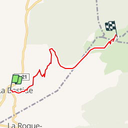

Length
5.5 km

Max alt
1702 m

Uphill gradient
750 m
Km-Effort
13.1 km

Min alt
989 m

Downhill gradient
42 m
Boucle
No
Creation date :
2019-01-14 09:45:28.632
Updated on :
2019-01-14 09:45:28.643
5h00
Difficulty : Unknown

FREE GPS app for hiking
 SityTrail
IGN / Geographical institutes
SityTrail Plus
The world is yours!
About
Trail Other activity of 5.5 km to be discovered at Provence-Alpes-Côte d'Azur, Var, La Bastide. This trail is proposed by olivieraron.
Positioning
Country:
France
Region :
Provence-Alpes-Côte d'Azur
Department/Province :
Var
Municipality :
La Bastide
Location:
Unknown
Start:(Dec)
Start:(UTM)
308681 ; 4845085 (32T) N.
Comments